A rangefinder reading can look wrong for three very different reasons: the device measured the wrong target, the display is showing a different type of distance, or the laser is genuinely inconsistent. The fix is to separate those possibilities with a repeatable baseline instead of comparing one number with a sprinkler head or GPS screen.
This article goes deeper on distance errors within our golf rangefinder troubleshooting workflow. Our editorial position is that “accuracy” should mean repeatable readings on a defined target—not one number that happens to match expectation.
The seven-check baseline
- Check yards, meters, or feet. A 150-meter result is about 164 yards. That difference feels like a fault if the unit indicator is missed.
- Turn slope off. Compare direct line-of-sight distance before evaluating a compensated or “play-as” value.
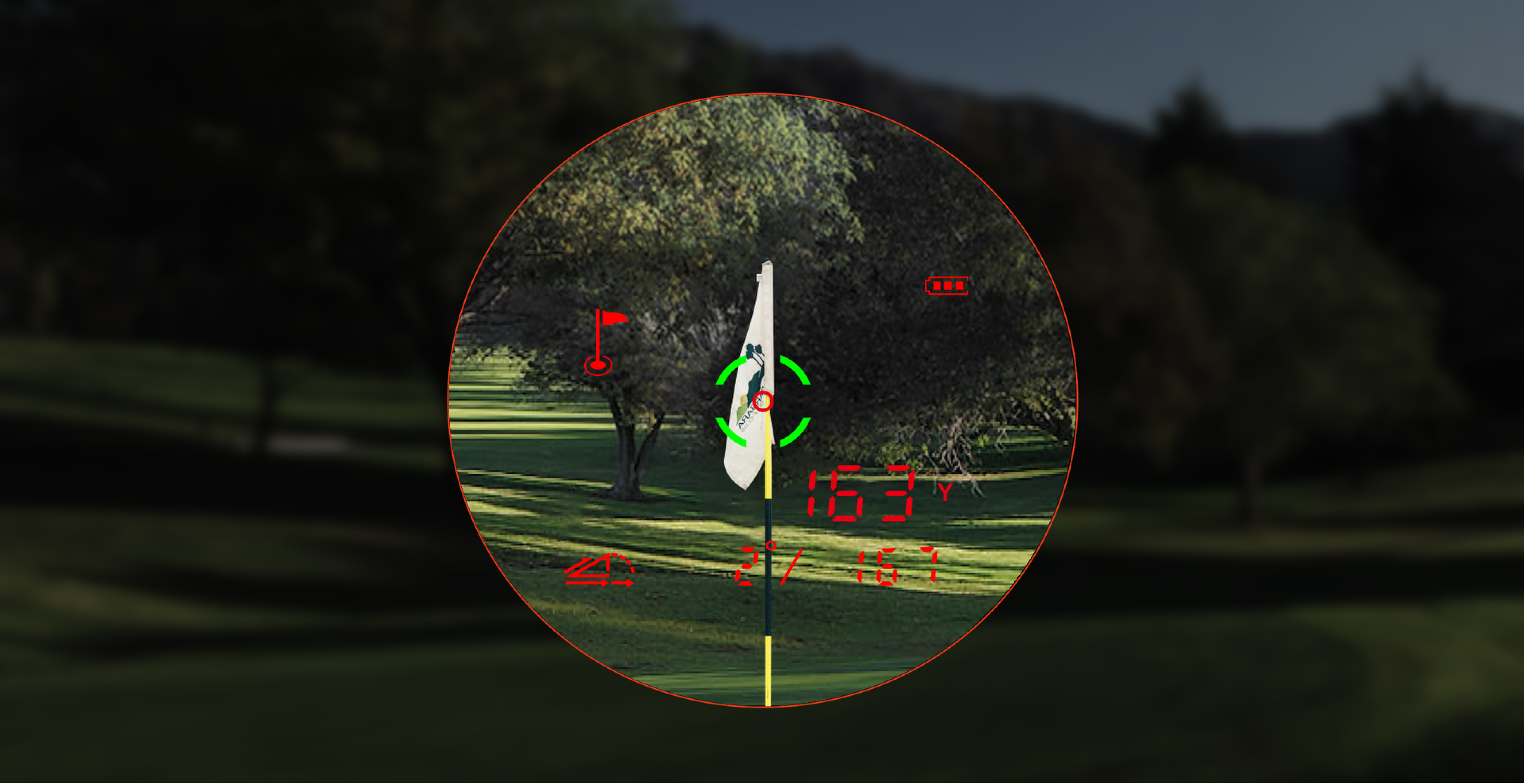
- Choose a large stationary target. Use a flat wall or large sign at moderate distance—not a moving cart, glass, water, thin flag, or tree line.
- Brace your body. Rest elbows against your torso or a stable surface.
- Take five independent readings. Lower and re-aim the device each time.
- Repeat at a second distance. A device that is stable at 100 yards but unstable only near its range limit may be encountering target or atmospheric limits.
- Change one condition. Try a larger target, shorter distance, or the model’s weather mode—one at a time.
The official MILESEEY GenePro G1 support page specifically tells users to verify units when readings are jumpy and notes that mist, rain, fog, target reflectivity, target angle, light, and target size can affect ranging. It also describes Rain & Fog mode for poor weather.
Read the five-shot pattern
| Pattern | What it suggests | Action |
|---|---|---|
| Five nearly identical values, all unexpected | Units, slope state, wrong target, or wrong reference expectation | Verify units and target; compare direct distance only |
| Four similar values and one much longer value | Background captured once | Improve aim or use flag-lock/scan mode |
| Values wander in a wide band | Hand movement, weak target return, weather, dirty exterior lens, or hardware | Brace, shorten distance, enlarge target, and retest |
| Stable on a wall but not on a flag | Target-acquisition issue rather than general distance accuracy | Use the flag-lock drill |
| Stable direct distance but surprising slope distance | Slope algorithm inputs or expectation | Confirm slope mode and compare like with like |
Do not compare unlike distances
-6.jpg?w=2560&h=1280)
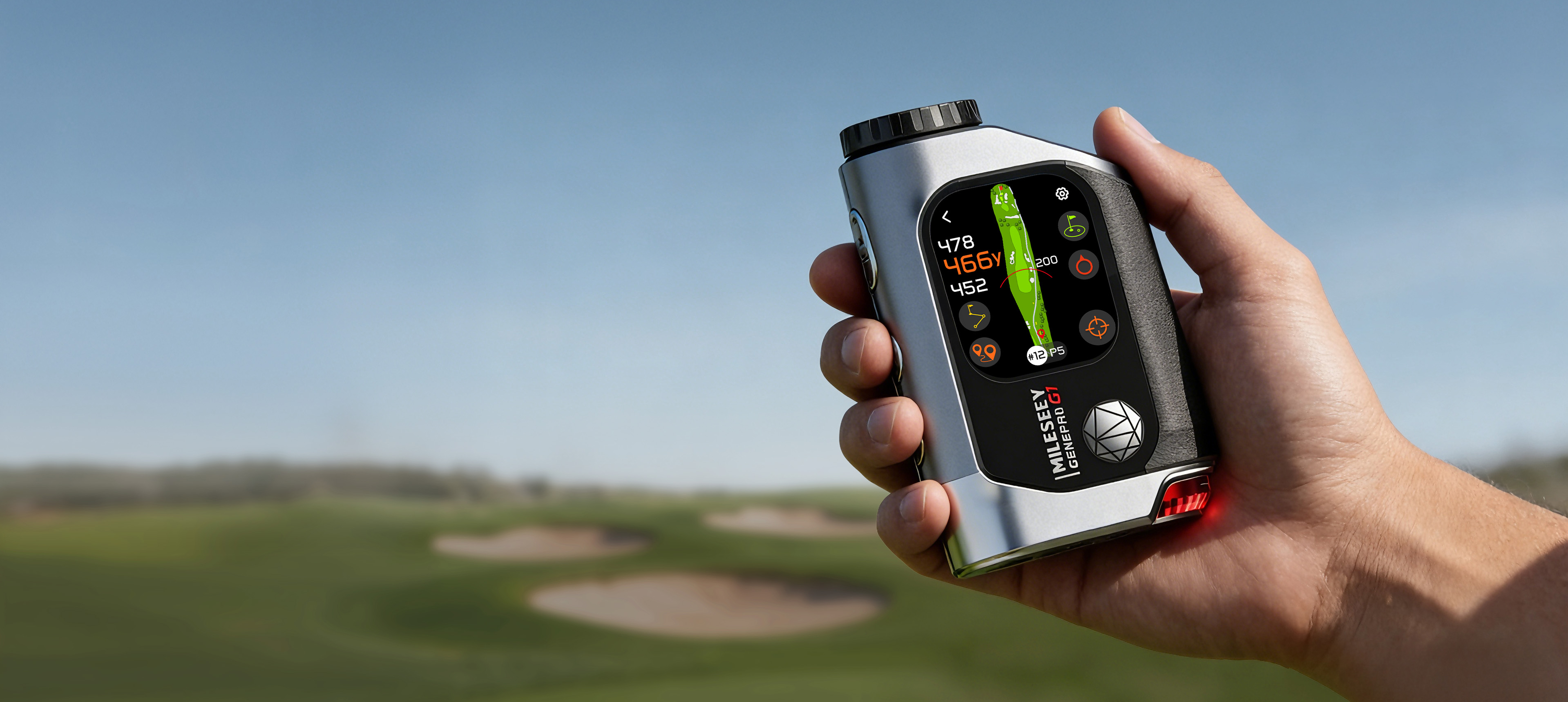
A hybrid device can show several valid numbers simultaneously. The MILESEEY GenePro G1 combines laser ranging with GPS front, center, and back green distances. The laser measures the point you aim at. GPS distances refer to mapped positions. A front-green GPS number does not need to equal a laser reading to the flag, and neither must equal a slope-adjusted number.
Sprinkler heads and course plates also have boundaries. They may be measured to the center of the green, may have shifted, or may not represent today’s pin. Use them as context, not as a laboratory reference.
Editorial simulation: 151, 166, or 173 yards?
This is an editorial simulation designed to show the decision process; it is not a first-party field test.
A player sees 151 on the laser, 166 on the GPS center number, and 173 as a slope-adjusted value. The instinct is to call the device inaccurate. But the three values answer different questions:
- 151 may be direct distance to the visible front pin.
- 166 may be mapped distance to the green center.
- 173 may be the model’s compensated “play-as” estimate for elevation and enabled environmental inputs.
The correct test is not to average them. It is to identify the label, turn slope off, laser a defined target five times, and compare that repeatability with the model’s documented tolerance.
Target selection changes the result
Laser rangefinders depend on returned light. Larger, flatter, more reflective surfaces generally return stronger signals than small, dark, angled, or moving targets. A flag against trees creates two plausible returns. Glass and water can create misleading reflections. Bright sunlight, cloud cover, rain, mist, and fog change the signal environment.
This does not mean any strange number is acceptable. It means the test must control target and conditions before diagnosing hardware. For the difficult pin case, follow the five-minute flag-lock method.
Model specifications define the boundary
Current official product data lists different measurement and flag-lock capabilities:
- MILESEEY PF260 Tour: up to 1,100 yards total range, 350-yard flag lock, and ±1-yard published accuracy.
- MILESEEY IONME2: up to 1,100 yards total range, 450-yard flag lock, and ±0.5 yard above 100 yards in the current support specifications.
- GenePro G1: up to 1,300 yards total range, 600-yard flag lock, and ±0.5-yard published accuracy.
- MILESEEY GenePro S1: up to 2,000 yards total range, 690-yard flag lock, and ±1-yard published accuracy above 100 yards.
These are official specifications, not our independent test results. Real target reflectivity, size, weather, steadiness, and background still matter.
Do not confuse compass calibration with laser calibration
Some hybrid devices include a compass or direction feature. GenePro G1 support provides a compass calibration process for Pin Pointer when direction is off. That does not mean the user can or should recalibrate the laser distance engine. Never use undocumented service menus, open the optical body, or adjust internal components.
When the result points to support
.png?w=1500&h=927)
Contact support if the device produces a repeatable error outside its documented tolerance on a large stationary target under dry moderate conditions, after units and slope are confirmed. Also contact support when values jump under the same controlled setup, the problem followed an impact or moisture event, or a display segment makes the unit/value ambiguous.
Send a compact test log:
| Field | Example |
|---|---|
| Model and firmware/course data state | Exact model; update status if applicable |
| Target and estimated distance | Large flat sign at a moderate distance |
| Conditions | Dry, daylight, no fog |
| Settings | Yards; slope off; standard mode |
| Five readings | Record every value in order |
| Second target result | Repeat at another distance |
When this advice does not apply
This process cannot certify survey-grade accuracy, validate an unknown course marker, or compare laser and GPS values that reference different points. It also should not be used after submersion, visible optical damage, or unauthorized repair. In those cases, stop and use the model support channel.
If your measurements are stable but the view or numbers are hard to see, use the display isolation test. If the device will not stay powered during the test, start with the power diagnostic.